Washington’s Treasure: Deception Pass State Park

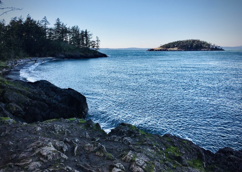
Looking west from Deception Pass State Park

Among the many Washington treasures are its state parks. We recently camped using our truck and camper at Deception Pass State Park. The park spreads over 3,854 acres and includes both saltwater shoreline and three lakes. Located in northwest Washington, the park has three campgrounds: Cranberry Lake and Quarry Pond Campgrounds located on Whidbey Island to the south and Bowman Bay on Fidalgo Island to the north. The two islands are connected by a pair of bridges known collectively as Deception Pass Bridge.

Campsites offer ocean, mountain, forest, or lake views. Visitor facilities include utility sites with water and electricity, and tent sites. All camping spaces are equipped with a picnic table and fire ring.

In addition to superb camping, the park offers services for water activities which include two docks, boat launches and moorage. Boating, kayaking, freshwater and saltwater fishing, crabbing, swimming, and SCUBA diving are among the many water activities enjoyed at the park.

The park offers 38 miles of hiking trails through lush forest lands and along shorelines. In addition, there are 1.2 miles of ADA hiking trails, 3 miles of bike trails, and 6 miles of horse trails.

Besides soaking in nature’s bounty in our spacious site at Cranberry Lake Campground, we enjoyed a morning drive north to Anacortes, known for the Washington State Ferries dock and terminal serving San Juan Islands as well as Victoria, British Columbia. Another day we drove south to Coupeville, the county seat of Island County, and the second oldest community in Washington. Nearby Keystone is also the jumping off point via ferry to the Olympic Peninsula.

From many places in the park, visitors can see work done by the Civilian Conservation Corps (CCC) in the 1930s. At the Bowman Bay campground a CCC building was renovated in 1987 that exhibits the incredible story of the CCC’s work across the State of Washington during the Great Depression.

We recently purchased a Washington State Park off-season senior citizen pass for $75. This pass entitles pass holders to free camping and moorage between October 1 and March 31, as well as Sundays through Thursdays in April. Our three-day camping trip to Deception Pass State Park paid for this pass, so for the rest of the season our camping will be free.

Deception Pass State Park, open all year, is one of Washington’s most popular parks. Reservations are highly recommended (www.parks.state.wa.us or call (888) CAMPOUT to make reservations).

Dungeness Recreation Area

Dungeness Recreation Area was a highlight of our recent visit to the Olympic Peninsula. This crown jewel of Clallam County Parks is located in the crest of the Peninsula with views of the Olympic Mountains to the south, and the Strait of Juan de Fuca and Vancouver Island to the north. To the east, Mount Baker and other peaks of the Cascade Range are visible, and to the west is Port Angeles.

The sixty-six spacious camp sites have fire rings and picnic tables. There are no utility hook-up sites. Many of the sites operate on a first-come, first-served basis. A separate bicycle camping area and a reservable group camp are also available.

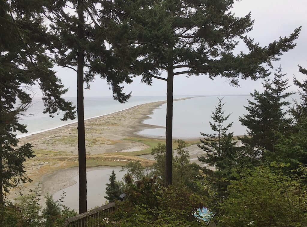
Plentiful equestrian and pedestrian trails meander throughout the park. One of our favorites was a bluff trail extending the length of the camp. Another easy half-mile walk led us through the forest to an overlook above Dungeness Spit.

A hiking trail also connects with the Dungeness National Wildlife Refuge, managed by the United States Fish and Wildlife Service, and open daily from sunrise to sunset. The trail continues down a steep hill to the Spit which becomes a 5-mile beach walk to the lighthouse. The refuge protects critical habitat for wildlife and provides viewing opportunities for visitors.

Dungeness Recreation Area can be used as a base camp with four day-use County parks within a five-minute drive, or the town of Sequim is a short ten-minute drive.

A lovely advantage of the area is that the local rainshadow creates an environment where it rains only eighteen inches a year with 254 mostly or partly sunny days. During the winter there are five times as many sunny days and a quarter of heavy overcast days compared to Seattle.

For a great destination filled with a variety of activities, it’s hard to beat the Olympic Peninsula for enjoying nature at its finest.

To learn more and to make reservations, visit: http://www.clallam.net/Parks/Dungeness.html

May 18, 1980: Remembering Mount St. Helens

Credit: USGS

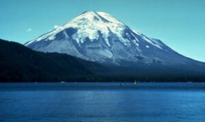
Mount St. Helens, a perfect snow-white, cone-shaped mountain, was a favorite showpiece among Washingtonians for generations. A popular vacation spot, it boasted of beautiful lakes, challenging hiking trails, with rustic vacation homes and resorts nestled on the shores of pristine Spirit Lake. Photographers came from across the country to capture the elegant symmetrical cone of “America’s Fujiyama.”

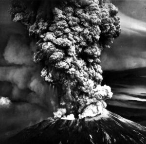
Forty years ago today, on May 18, 1980, Mount St. Helens exploded in a violent eruption, following many earthquakes that spring. The blast blew off the top 1,300 feet of the mountain with five hundred times the force of the Hiroshima atomic blast. Within hours, the explosion destroyed 234 square miles of forest. Trees were either blasted away, snapped like pieces of straw, or scorched while standing, reducing one of the world’s most superb mountain landscapes to a gray wasteland.

Fifty-seven people lost their lives, though only about half those bodies were recovered. Most deaths were due to suffocation, others died from burns or as a result of falling objects. Of the lives lost, a few were scientists, but most fatalities were sightseers who had been repeatedly warned to stay clear of the area. An estimated 7,000 deer, elk and bear, and untold thousands of birds and small animals also perished. The Toutle River grew so hot witnesses reported seeing fish jump out of the water to escape the heat.

Credit: USGS

When Mount St. Helens first erupted, it sent a low-frequency shock wave straight up, which in turn reflected off several layers of the atmosphere and then bounced back to the ground in a large donut-shaped ring fifty to three hundred miles around the mountain. Thus, most people within fifty miles of the mountain did not hear the blast, yet it was heard as far away as Canada.

A menacing plume of ash boiled 60,000 feet into the atmosphere as the mountain turned itself inside out. The heavy ash cloud swept eastward across the continent in three days, and circled the globe in seventeen days. In Yakima, Washington, 138 miles from Mount St. Helens, emergency crews removed an estimated 600,000 tons of ash from the business district and residential areas. Ash flattened wheat fields and weighted down fruit trees. Agricultural losses in the Pacific Northwest totaled millions of dollars.

The blast and subsequent floods ruined or severely damaged more than three hundred homes, along with farm buildings and equipment. Hundreds of livestock were lost, either swept away in flood waters or buried in debris. Massive mudflows wiped out roads and bridges. For months afterward, extensive repair work was undertaken to regain use of the Columbia River and its tributaries.

Campers and loggers miles away from the blast zone heard an aftermath roar that one person described as sounding “like a couple of big passenger jetliners coming through the woods.” Within seconds, darkness covered the area and a terrific heat rolled in, burning people, animals and trees within its path.

My award-winning novel Tenderfoot is a work of fiction taking place during the months surrounding the Mount St. Helens eruption. Although the characters have been fictionalized, various experiences of blast victims represent true accounts.

San Antonio’s Briscoe Art Museum

While in San Antonio, Texas to attend a writers conference, we toured the amazing Briscoe Western Art Museum. It was a tour to remember.

The museum is housed in a renovated historical building, a 1930s structure that once served as the city’s library. The Briscoe, located downtown San Antonio on the River Walk, opened in 2013. The museum, the city’s first dedicated Western art museum, features hundreds of western objects, including a full-size reproduction of a Wells Fargo stagecoach, and an actual chuck wagon used on cattle trail drives. Walls and display cases of saddles and spurs fire the imagination and bring the old West to life. In addition to cowboy culture, the museum also explores American Indian, Spanish and Mexican contributions to the area.

The museum’s three levels feature the story of the West through paintings and sculptures, from ancient concepts to the place we know today. Each floor has a theme showing the diversity of cultures, ideas and commerce.

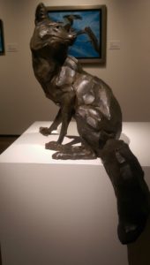
In addition to the permanent displays, the museum also has a rotating display of the newest acquisitions. When we visited, the Briscoe featured a very large exhibit, the Art and the Animal, the flagship exhibition of The Society of Animal Artists.

Outside, the McNutt Sculpture Garden provides visitors a leisurely courtyard stroll among bronze sculptures depicting figures of the American West.

The Briscoe Western Art Museum Store has an impressive selection of merchandise including books, jewelry, arts and crafts, all relating to the Museum’s collection.

If you’re in San Antonio, be sure to visit the Briscoe Western Art Museum. It offers a memorable tour of yesterday and today’s American West.

Photos by April Brauneis   


A Unique Adventure:Deception Pass Tours

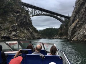
View of Deception Pass Bridge from the tour boat

Our family recently experienced a unique tour of Deception Pass, a strait separating north Whidbey Island from Fidalgo Island in northwest Washington. The Pass, which connects Skagit Bay, part of Puget Sound, with the Strait of Juan de Fuca, has an extremely strong tidal current. The bridge that spans the area is actually two bridges known collectively as Deception Pass Bridge, completed in 1935 and declared a National Historic Landmark in1982.

Ten members of our family boarded the Island Whaler, a jet-drive catamaran, operated by Deception Pass Tours. The boat holds thirty-three passengers, each one getting a comfortable seat on an open deck with a 360°unobstructed view.

As we sailed, the captain and his assistant pointed out interesting sights and the history behind them, such as the prison rock quarry that operated from 1910 through 1914. The quarry, located on a steep cliff, was worked by members of an honors program out of Walla Walla State Prison.

Before the Deception Pass Bridge was built, travelers had to cross on an unscheduled ferry, summoned by a mallet against a metal lumberjack saw which sounded a “boing.” The operator, Washington’s first woman ferry boat captain, would pick them up.

At times our captain brought the boat to a stop so that we could view and take pictures of the bridge, seals, porpoises and the many species of birds that reside in the area. Whales are sometimes seen in these waters, too.

If you’re in northwest Washington, the one-hour Deception Pass Tour is a delightful way to experience a unique, picturesque view of the shores, waters, rugged cliffs and evergreen forests of the area.

For more information and to book a tour:
1-888-909-8676
www.DeceptionPassTours.com


Orcas Island: The Gem of the San Juans

We recently enjoyed a few days on Orcas Island, the largest island in the San Juans. Accessible only by air or sea, we took a ferry from Anacortes, north of Seattle for a scenic 1¼ hour sail to Orcas Island.

Orcas is slightly larger, but less populated than neighboring San Juan Island. Orcas is shaped like a pair of saddlebags, separated by fjord-like Eastsound, with Massacre Bay on the south side, and tiny Skull Island just off the coast. We drove through the hamlet of Eastsound, the island’s commercial center and the largest populated village on the Island. Smaller hamlets include Orcas (where the ferry lands), West Sound, Deer Harbor, Rosario, Olga and Doe Bay.

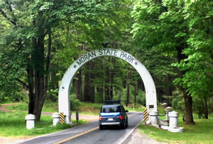
The main beauty of this hilly island is its lush forests and sweeping green farmland. Our destination, 5,252-acre Moran State Park, is one of the most beautiful spots in the Pacific Northwest. Here hikers can enjoy 38 miles of trails ranging from gentle forest paths to challenging ascents. For those looking for a demanding hike, Mount Constitution fills the bill with a 2,409-foot summit—the highest point in the San Juan Islands. A castle-like tower stands at the summit. Stairs leading to the top will reward the ambitious climber views that include the Cascade and Olympic mountain ranges, Mount Baker and Mount Rainier. Spread below are the green forested San Juan Islands, Canadian Gulf Islands and Vancouver Island.

Wildlife and plants are abundant on Orcas. Blacktail deer, river otters, mink and raccoons are common in the park. Bald eagles, kingfishers and great blue herons can be seen year round. In the winter, trumpeter swans and a variety of ducks are found on Cascade Lake.

We found the campsite spacious and moderately private. The park is quite hilly which might be restrictive for some people. Space for large rigs is limited. I suggest always making reservations, both for the ferry and for camping.

Orcas Island is a Northwest treasure whether you want to camp, or stay at one of its several bed and breakfasts or resorts. It’s a magical mix of arts and culture, lush forests, placid lakes and endless outdoor possibilities. Come see for yourself what the locals call “The gem of the San Juans.”

To make reservations:

Washington State Ferries https://secureapps.wsdot.wa.gov/Ferries/Reservations/Vehicle/default.aspx

Washington State Parks:
https://parks.state.wa.us/223/Reservations

♬ Where the Deer and Antelope Play ♬

To experience unique wildlife, Hart Mountain National Antelope Refuge fills the bill. In this remote wilderness you may experience wildlife in a dramatic setting so stark it will take your breath away. Located in the high desert country of south central Oregon, and maintained by U.S. Fish and Wildlife Service, the refuge is open to the public year round.

Hart Mountain is a rugged, massive fault block ridge rising 8,065 feet above sea level. The craggy west side ascends abruptly from the floor of Warner Valley to dramatic, colorful cliffs and ridges. Several deep gorges slash the ridges. The east side of Hart Mountain is less rugged and forms a series of more gentle hills and low ridges. Its lower regions grow sagebrush and grass ranges typical of south central Oregon.

Because of its many springs, Hart Mountain has been called an oasis in the desert. The refuge at Hart Mountain is remote with no grocery or gasoline facilities available. May through October is the best season to visit the refuge. Even then, road conditions may limit access to parts of the area. RVers, especially those with large rigs, may want to consider driving to the refuge in a smaller vehicle.

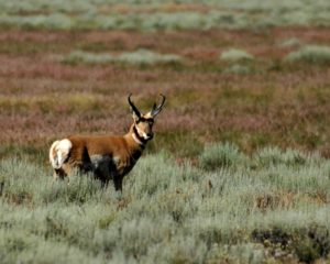
We were on a sharp lookout for antelope, sometimes called pronghorn. Antelope are shy animals and will bolt at the slightest fear of danger. Antelope, North America’s swiftest mammal, can reach speeds of more than 40 miles an hour and can cover 20 feet in one leap. These deerlike animals are characterized by their curved, hollow horns with a single forward-projecting prong on each horn. The antelope’s tan body has a white belly and two white stripes on the neck and chest.

At one time, before the settlers came to America, Hart Mountain was the home of bighorn sheep. Indigenous writing on rock walls shows figures of wild sheep, indicating they were an important source of food. The first settlers also hunted the sheep. Large herds of domestic livestock were eventually brought into the area causing competition for forage. Diseases introduced to the bighorn sheep also contributed to their disappearance by the early 1900s. In November 1954, 20 bighorn sheep were donated by British Columbia, reestablishing the bighorn at Hart Mountain.

Visitors normally have to work to see bighorn sheep although herds are occasionally seen from the road. Usually, they are easier to spot along cliff areas if you are above them, which means taking a steep hike. Bighorns have the capacity for climbing and jumping due to the structure of their hoofs. The halves of each hoof separate allowing the feet to cling firmly to rocky terrain.

Mule deer are routinely spotted anytime of year, though spring and summer are the best times. The mule deer, named for their large, mule-like ears, avoid human activity but can be seen along forest edges or on brushy slopes in the foothills.

About 200 resident migratory bird species use the refuge, often seen along riparian areas along the edge of a stream or river. The air is alive with their songs. Sage grouse are often spotted around meadows and their kuk, kuk, kuk can be heard as they search for food among the sagebrush.

Wild flowers abound throughout the refuge. In June, fields of iris danced in colorful display. We also found Indian paintbrush and brilliant yellow arrowleaf balsamroot. Photographers will find plenty of subjects to capture.

The thirty campsites on Hart Mountain’s Hot Spring Campground are primitive with no RV hookups, drinking water, firewood or fire rings. There are pit toilets, two of which are handicap accessible. Drinking water is available at headquarters. There are no reservations and no camping fees. A hot springs enclosure allows visitors to enjoy warm waters with an open view of the sky.

Visitors might consider making this refuge a day trip and camp in the Lakeview area where there are U.S. Forest Service camps or Goose Lake Oregon State Park. Goose Lake, off US 395, 14 miles south of Lakeview, has 48 sites with electricity and water. Showers are available and there is a dumping station. The park has boat facilities and excellent wildlife viewing. The lake spans two states, Oregon and California.

Be sure to visit the Refuge headquarters which has several interesting displays and pamphlets.

An interesting outside display identified many of the native plants found on the refuge: wild-rye, hawksbeard, Indian ricegrass, low sagebrush, rough fescue, Idaho fescue, balsamroot, bluebunch wheatgrass, bitterbrush, and big sagebrush. Each of these plants is vitally important to ensure adequate cover and nutrition for many resident species.

If you’re looking for a memorable wildlife experience, consider visiting Hart Mountain National Antelope Refuge. You’ll be awe-inspired with the spectacular views and fascinated with the abundant wildlife.

For more information, visit https://www.fws.gov/refuge/Hart_Mountain/visit/plan_your_visit.html

Whale Watching in the Northwest: A Unique Experience

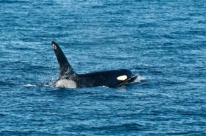
Image by Bruce Trimble

If you’re in the Northwest, consider a whale watching cruise. We chose to sail with Island Adventure out of Anacortes, Washington.

On a brilliant sunny day, we sailed out through the San Jan Islands and into the Strait of Juan de Fuca.

The San Juan Islands are among the best places in the world to view orca and minke whales. The area is home to three pods of resident whales who are numbered and named. Orca whales have been returning to the area for hundreds of years and feed on Pacific Northwest salmon.

We cruised for a while before spotting our first whale, then we saw many as they cavorted in the water, expelling air through their blowholes as they fished for salmon. We saw many salmon jumping, probably trying to escape from their predators. The orca is a beautiful species with glossy black back and white belly, white eye patch, and grayish white saddle patch. The dorsal fin may be three to six feet long. The coloration of the orca’s dorsal fin and saddle patches are distinct, and these unique physical characteristics are used to identify individual whales. Adult orcas weigh 7,000 to 25,000 pounds, measure 17 to 32 feet, and can live 100 or more years.

During different times of the year, other whales—the minke, gray and humpback—also can be seen in these waters.

With each sighting, our on-board naturalist identified many of the orca by their pod names, J, K or L, and then their sub-groups consisting of mothers and offspring. We were able to observe a mother with her calf on several occasions as she showed off her baby to us. The boat kept a respectable, legal distance from the whales as required by law.

The orca is really not a whale at all, but is the largest member of the dolphin family. However, it is commonly called a whale because of its size and habits. The distinctive black and white orcas are probably the most studied group of marine mammals in the world. They are regarded by some scientists as the third most intelligent animal on the planet, after humans and chimpanzees.

Orca, sometimes called “killer whale” are an endangered species in Washington, Oregon and California. When viewing, observers should stay at least 200 yards away, using binoculars or cameras with zoom lenses for a closer view. If the wildlife approaches the boat, the engines should be placed in neutral, giving wildlife the right-of-way.

Whale watching tours are scheduled March through October. The orca population is decreasing at an alarming rate due to many factors. To learn more about whales and what can be done to protect this amazing mammal, visit whaleresearch.com

The North Cascades: On the Wild Side

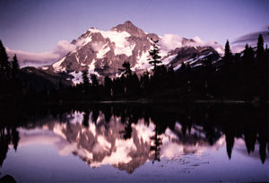
North Cascades: Mt. Shuksan

Wilderness camping appeals to our souls—to hear birds chirp, the owl’s hoot, the marmot’s whistle, and the rustle of something furry darting for cover. We long for the smell of fertile earth and pure, clean air. We crave to see mile after mile of dense forests punctuated with cascading waterfalls. We need to take a break from crowds and the modern conveniences of man. The allure of wilderness camping is fulfilled in the Mt. Baker-Snoqualmie National Forest in the North Cascades. There, in the Darrington Ranger District campgrounds, we can enjoy as much of a wilderness experience as possible while still close to access roads.

Camp Sites Galore
Many campgrounds in the Darrington Ranger District are dry camps with no source of drinking water and no garbage pickup. There are tables, campfire pits, and vault toilets. The campgrounds are usually less crowded and remote, often with spacious campsites.

Mountain Loop Highway
The gravel, winding Mountain Loop Highway offers splendid scenery and several primitive and secluded campgrounds. Towering stands of Douglas Fir, hemlock, and cedar offer resplendent forest panoramas. As you drive south from Darrington, Clear Creek is the first campground followed by Bedal.

Approaching the Mountain Loop Highway from Granite Falls and driving east, there are three fee site camping grounds which have drinking water and garbage pickup: Turlo, Gold Basin and Verlot. Other campgrounds dotted along the Mountain Loop Road are: Clear Creek, and Red Bridge. Group campgrounds, for which you must make reservations, are also along this stretch of road: Wiley Creek, Tulalip, Marten Creek, Esswine, Coal Creek and Beaver Creek and Boardman.

Hiking in the Wild
In addition to camping, the Mt. Baker-Snoqualmie National Forest offers 360 miles of hiking and horse trails in the three wilderness areas: Henry M. Jackson, Boulder River, and Glacier Peak. These hiking routes have all degrees of difficulty and length, from level, easy trails to exhilarating climbs to mountain peaks. Due to changing weather and trail conditions, it’s always a good idea to check in with the Darrington or Verlot offices for detailed information on the hike you plan to take.

Visitors Center, North Cascades National Park at Newhalem
The Visitors Center at Newhalem east on Highway 20 in the North Cascades National Park is definitely worth a stop. At the west end of Newhalem, turn south and cross the one-lane bridge. Outstanding displays are featured here with life-size pictures, videos, and models of animals and birds accompanied by the sounds of wildlife.

Detailed topographic maps on the lobby walls show the North Cascades National Park in its larger context. If you are in the Newhalem area, do stop by this popular Visitors Center to learn how wilderness is being managed for the benefit of wildlife and for those who visit it.

The North Cascades National Park Service complex, made up of North Cascades National Park, Ross Lake and Lake Chelan National Recreation Areas, emphasizes understanding and managing wilderness lands in the larger ecological context. By linking public lands such as the Stephen Mather Wilderness which adjoins over two million acres of U.S. Forest Service wilderness areas and British Columbia Parks, rare animals such as gray wolves and grizzly bears roam without regard to human boundaries. The goal of the custodian of these public lands is to preserve this area’s natural and cultural resources and to provide for their enjoyment by the public.

Wilderness can no longer be thought of in 1960’s terms of “A place untrammeled by man.” There is hardly a place on earth that has not felt the effects of human activities. We must now think of wilderness as a part of the natural world to which we all belong. We have the privilege of enjoying and experiencing these pristine and beautiful places along with the responsibility to preserve our precious wilderness for future generations.

Try camping and hiking in the wilderness sites in the North Cascades and feel your own soul stirring. Nature’s treasure is there for us to enjoy and appreciate. And to protect.

Fort Spokane: Stepping into the Past

To walk the grounds of Fort Spokane is to walk in the footsteps of change. Fort Spokane has a changing story, from serving as a frontier military post, to an Indian boarding school, a tuberculosis hospital and sanitarium, and now as a National Park. Fort Spokane is part of the Lake Roosevelt National Recreation Area and located above the confluence of the Spokane and Columbia Rivers in eastern Washington.

Built in1880, Fort Spokane first served as a frontier military post. Many soldiers joined the Army hoping to see fighting on the frontier, but the fight against boredom was the only battle the soldiers at Fort Spokane waged. Their monotonous life consisted of waking to the bugle call, eating breakfast, marching the Parade Ground, working in the bakery or standing guard at the Guardhouse, march and drill the manual of arms in the afternoon, play baseball in the evening if weather permitted, eat dinner and go to bed. The tedious days became more than many soldiers could bear. Some turned to drink; some ran away. The guardhouse, originally built to house prisoners of war, ironically housed errant soldiers. The fort closed in 1898 when the soldiers were transferred to Cuba to fight in the Spanish-American War.

Fort Spokane was decommissioned and transferred to the Bureau of Indian Affairs. The fort opened as an Indian boarding school in 1900. Children ages five to sixteen from the Spokane and Colville tribes were removed from their families and sent miles away to the Indian Boarding School at Fort Spokane. At first they did not understand the language of the teachers and staff, yet were not allowed to speak their own language–not even to each other. They were not allowed to wear their native clothing or practice their spiritual traditions. Strict discipline and harsh punishments were the norm. The boys were trained to learn a trade such as gardening and tending chickens and cows. The girls were taught how to keep house and other domestic chores. It was a time of suffering both for the children and for their parents. The school operated from 1900 to 1907.

The last people to occupy the fort were the doctors, nurses and patients of the tuberculosis sanitarium and Indian hospital until Fort Spokane’s final closure in 1929.

Fort Spokane became a part of the National Park Service in 1960. Major restoration involved four of the remaining buildings: the Quartermaster Stable built in 1884, the Powder Magazine built in 1888, the Reservoir built in 1889, and the Guardhouse built in 1892. These structures can be seen today and visitors are encouraged to tour the grounds and buildings. The National Park Service maintains the grounds at Fort Spokane to preserve these stories for future generations.